Carlentini (munisipyo) Saysay | Ang mga gi basihan niini | Gikan sa gawas nga tinubdan | Menu sa nabigasyon37°16′10″N 15°00′45″E / 37.26955°N 15.01259°Ö / 37.26955; 15.0125937°16′10″N 15°00′45″E / 37.26955°N 15.01259°Ö / 37.26955; 15.012596539208dinhiCarlentiniGeonames.org (cc-by)Viewfinder Panoramas Digital elevation ModelUpdated world map of the Köppen-Geiger climate classification10.5194/hess-11-1633-2007NASA Earth Observations Data Set IndexNASA Earth Observations: Rainfall (1 month - TRMM)
Italya paghimo ni botPaghimo ni bot 2016-09Geobox usage tracking for region typeMga subdibisyon sa Sicilia (rehiyon sa Italya)
MunisipyoInitalyanoItalyaProvincia di SiracusaSiciliaRomeAugustaBuccheriCataniaFerlaFrancofonteLentiniMelilliSortinomediteranyo°C°C
Carlentini (munisipyo)
Jump to navigation
Jump to search
 | Paghimo ni bot Lsjbot. |
- Alang sa ubang mga dapit sa mao gihapon nga ngalan, tan-awa ang Carlentini.
| Carlentini | |
| Munisipyo | |
 | |
Opisyal nga ngaran: Comune di Carlentini | |
| Nasod |  Italya Italya |
|---|---|
| Rehiyon | Sicilia |
| Lalawigan | Provincia di Siracusa |
| Gitas-on | 205 m (673 ft) |
| Tiganos | 37°16′10″N 15°00′45″E / 37.26955°N 15.01259°Ö / 37.26955; 15.01259 |
| Area | 157.00 km2 (61 sq mi) |
| Population | 17,958 (2014-01-02) [1] |
| Density | 114 / km2 (295 / sq mi) |
| Timezone | CET (UTC+1) |
| - summer (DST) | CEST (UTC+2) |
| Postal code | 96013 |
| GeoNames | 6539208 |
 | |
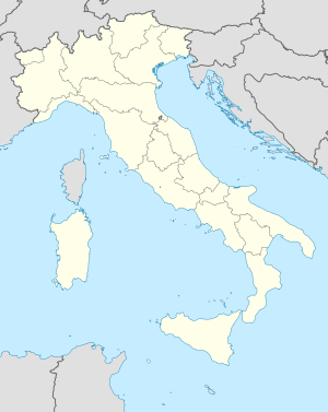
Munisipyo ang Carlentini (Initalyano: Comune di Carlentini) sa Italya.[1] Nahimutang ni sa lalawigan sa Provincia di Siracusa ug rehiyon sa Sicilia, sa habagatang bahin sa nasod, 600 km sa habagatan sa Rome ang ulohan sa nasod. Adunay 17,958 ka molupyo.[1] Naglangkob kin og 157 ka kilometro kwadrado. Carlentini mopakigbahin sa usa ka utlanan sa Augusta, Buccheri, Catania, Ferla, Francofonte, Lentini, Melilli, ug Sortino.
Ang yuta sa Carlentini kay kabungtoran sa habagatang-sidlakan, apan sa amihang-kasadpan nga kini mao ang patag.[saysay 1]
Ang klima mediteranyo.[3] Ang kasarangang giiniton 19 °C. Ang kinainitan nga bulan Hulyo, sa 31 °C, ug ang kinabugnawan Enero, sa 9 °C.[4] Ang kasarangang pag-ulan 721 milimetro matag tuig. Ang kinabasaan nga bulan Nobiyembre, sa 118 milimetro nga ulan, ug ang kinaugahan Hunyo, sa 4 milimetro.[5]
| ||||||||||||||||||||||||||||||||||||||||||||||||||||||||||||||||||||||||||||||||||||||||||||||||||||||||||||||||||||||||||||

Saysay |
↑ Kalkulado gikan sa gitas-on data (DEM 3") gikan sa Viewfinder Panoramas.[2] Ang bug-os nga algoritmo anaa dinhi.
Ang mga gi basihan niini |
↑ 1.01.11.2 Carlentini sa Geonames.org (cc-by); post updated 2014-01-02; database download sa 2016-08-15
↑ Viewfinder Panoramas Digital elevation Model (2015-06-21).
↑ Peel, M C; Finlayson, B L. "Updated world map of the Köppen-Geiger climate classification". Hydrology and Earth System Sciences 11: 1633-1644. doi:, http://www.hydrol-earth-syst-sci.net/11/1633/2007/hess-11-1633-2007.html. Gikuha sa 30 Enero 2016.
↑ 4.04.1 NASA Earth Observations Data Set Index. NASA.
↑ NASA Earth Observations: Rainfall (1 month - TRMM). NASA/Tropical Rainfall Monitoring Mission.
Gikan sa gawas nga tinubdan |

Mga kategoriya:
- Italya paghimo ni bot
- Paghimo ni bot 2016-09
- Geobox usage tracking for region type
- Mga subdibisyon sa Sicilia (rehiyon sa Italya)


(window.RLQ=window.RLQ||[]).push(function()mw.config.set("wgPageParseReport":"limitreport":"cputime":"1.516","walltime":"2.525","ppvisitednodes":"value":41275,"limit":1000000,"ppgeneratednodes":"value":0,"limit":1500000,"postexpandincludesize":"value":393808,"limit":2097152,"templateargumentsize":"value":74571,"limit":2097152,"expansiondepth":"value":23,"limit":40,"expensivefunctioncount":"value":0,"limit":500,"unstrip-depth":"value":1,"limit":20,"unstrip-size":"value":4673,"limit":5000000,"entityaccesscount":"value":1,"limit":400,"timingprofile":["100.00% 2422.091 1 -total"," 93.64% 2267.953 1 Plantilya:Geobox"," 81.26% 1968.186 2 Plantilya:Coord"," 79.79% 1932.591 2 Plantilya:CountryAbbr"," 76.83% 1860.982 2 Plantilya:CountryAbbr2"," 71.58% 1733.646 1 Plantilya:Geobox2_coor_title"," 42.68% 1033.834 629 Plantilya:Flag"," 10.18% 246.634 1 Plantilya:Geobox2_coor"," 7.58% 183.524 629 Plantilya:Country_flag2"," 2.10% 50.894 1 Plantilya:Climate_chart"],"scribunto":"limitreport-timeusage":"value":"0.051","limit":"10.000","limitreport-memusage":"value":1386154,"limit":52428800,"cachereport":"origin":"mw1267","timestamp":"20190501024906","ttl":2592000,"transientcontent":false););"@context":"https://schema.org","@type":"Article","name":"Carlentini (munisipyo)","url":"https://ceb.wikipedia.org/wiki/Carlentini_(munisipyo)","sameAs":"http://www.wikidata.org/entity/Q174965","mainEntity":"http://www.wikidata.org/entity/Q174965","author":"@type":"Organization","name":"Contributors to Wikimedia projects","publisher":"@type":"Organization","name":"Wikimedia Foundation, Inc.","logo":"@type":"ImageObject","url":"https://www.wikimedia.org/static/images/wmf-hor-googpub.png","datePublished":"2016-09-11T03:35:53Z","dateModified":"2018-03-27T13:43:12Z","image":"https://upload.wikimedia.org/wikipedia/commons/0/00/Carlentini-Panorama.JPG","headline":"munisipyo sa Italya"(window.RLQ=window.RLQ||[]).push(function()mw.config.set("wgBackendResponseTime":122,"wgHostname":"mw1255"););


