Landkreis Erlangen-Höchstadt Saysay | Ang mga gi basihan niini | Gikan sa gawas nga tinubdan | Menu sa nabigasyon49°38′24″N 10°54′09″E / 49.64003°N 10.90242°Ö / 49.64003; 10.9024249°38′24″N 10°54′09″E / 49.64003°N 10.90242°Ö / 49.64003; 10.902423220799dinhiLandkreis Erlangen-HöchstadtGeoNames.Org (cc-by)Viewfinder Panoramas Digital elevation ModelNASA Earth Observations: Land Cover ClassificationNASA Earth Observations: Population DensityUpdated world map of the Köppen-Geiger climate classification10.5194/hess-11-1633-2007NASA Earth Observations Data Set IndexNASA Earth Observations: Rainfall (1 month - TRMM)
Alemanya paghimo ni botPaghimo ni bot 2016-01Geobox usage tracking for region typeMga subdibisyon sa Bavaria
DistritoAlemanyaRegierungsbezirk MittelfrankenBavariaBerlinLandkreis Neustadt an der Aisch-Bad WindsheimLandkreis FürthNürnbergErlangenNürnberger LandLandkreis ForchheimLandkreis Bambergkaumahanhemiboreal°C°C
Landkreis Erlangen-Höchstadt
Jump to navigation
Jump to search
| Paghimo ni bot Lsjbot. |
| Landkreis Erlangen-Höchstadt | ||
| Distrito | ||
| ||
| Nasod | ||
|---|---|---|
| Estado pederal | Bavaria | |
| Distrito nga gobyerno | Regierungsbezirk Mittelfranken | |
| Gitas-on | 287 m (942 ft) | |
| Tiganos | 49°38′24″N 10°54′09″E / 49.64003°N 10.90242°Ö / 49.64003; 10.90242 | |
| Area | 565.00 km2 (218 sq mi) | |
| Population | 131,227 (2014-02-10) [1] | |
| Density | 232 / km2 (601 / sq mi) | |
| Timezone | CET (UTC+1) | |
| - summer (DST) | CEST (UTC+2) | |
| GeoNames | 3220799 | |
 | ||
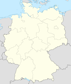
Distrito ang Landkreis Erlangen-Höchstadt sa Alemanya.[1] Nahimutang ni sa distrito nga gobyerno sa Regierungsbezirk Mittelfranken ug estado pederal sa Bavaria, sa habagatang bahin sa nasod, 400 km sa habagatan-kasadpan sa Berlin ang ulohan sa nasod. Adunay 131,227 ka molupyo.[1] Naglangkob kin og 565 ka kilometro kwadrado. Landkreis Erlangen-Höchstadt mopakigbahin sa usa ka utlanan sa Landkreis Neustadt an der Aisch-Bad Windsheim, Landkreis Fürth, Nürnberg, Erlangen, Nürnberger Land, Landkreis Forchheim, ug Landkreis Bamberg.
Ang yuta sa Landkreis Erlangen-Höchstadt kay patag sa habagatang-kasadpan, apan sa amihang-sidlakan nga kini mao ang kabungtoran.[saysay 1]
Landkreis Erlangen-Höchstadt may sa mosunod nga mga subdibisyon:
- Weisendorf
- Wachenroth
- Vestenbergsgreuth
- Höchstadt an der Aisch
- Mühlhausen
- Lonnerstadt
- Heroldsberg
- Eckental
- Herzogenaurach
- Baiersdorf
- Uttenreuth
- Spardorf
- Röttenbach
- Oberreichenbach
- Möhrendorf
- Marloffstein
- Kalchreuth
- Heßdorf
- Hemhofen
- Großenseebach
- Gremsdorf
- Buckenhof
- Bubenreuth
- Aurachtal
- Adelsdorf
- Neunhofer Forst
- Mark
- Kraftshofer Forst
- Kalchreuther Forst
- Geschaidt
- Forst Tennenlohe
- Erlenstegener Forst
- Dormitzer Forst
- Buckenhofer Forst
- Birkach

Hapit nalukop sa kaumahan ang palibot sa Landkreis Erlangen-Höchstadt.[3] Dunay mga 1,018 ka tawo kada kilometro kwadrado sa palibot sa Landkreis Erlangen-Höchstadt may kaayo hilabihan populasyon.[4] Ang klima hemiboreal.[5] Ang kasarangang giiniton 9 °C. Ang kinainitan nga bulan Hulyo, sa 22 °C, ug ang kinabugnawan Enero, sa -6 °C.[6] Ang kasarangang pag-ulan 937 milimetro matag tuig. Ang kinabasaan nga bulan Mayo, sa 112 milimetro nga ulan, ug ang kinaugahan Marso, sa 24 milimetro.[7]
Saysay |
↑ Kalkulado gikan sa gitas-on data (DEM 3") gikan sa Viewfinder Panoramas.[2] Ang bug-os nga algoritmo anaa dinhi.
Ang mga gi basihan niini |
↑ 1.01.11.2 Landkreis Erlangen-Höchstadt sa GeoNames.Org (cc-by); post updated 2014-02-10; database download sa 2015-05-23
↑ Viewfinder Panoramas Digital elevation Model (2015-06-21).
↑ NASA Earth Observations: Land Cover Classification. NASA/MODIS.
↑ NASA Earth Observations: Population Density. NASA/SEDAC.
↑ Peel, M C; Finlayson, B L. "Updated world map of the Köppen-Geiger climate classification". Hydrology and Earth System Sciences 11: 1633-1644. doi:, http://www.hydrol-earth-syst-sci.net/11/1633/2007/hess-11-1633-2007.html. Gikuha sa 30 Enero 2016.
↑ NASA Earth Observations Data Set Index. NASA.
↑ NASA Earth Observations: Rainfall (1 month - TRMM). NASA/Tropical Rainfall Monitoring Mission.
Gikan sa gawas nga tinubdan |

Mga kategoriya:
- Alemanya paghimo ni bot
- Paghimo ni bot 2016-01
- Geobox usage tracking for region type
- Mga subdibisyon sa Bavaria
(window.RLQ=window.RLQ||[]).push(function()mw.config.set("wgPageParseReport":"limitreport":"cputime":"1.536","walltime":"2.359","ppvisitednodes":"value":40161,"limit":1000000,"ppgeneratednodes":"value":0,"limit":1500000,"postexpandincludesize":"value":314529,"limit":2097152,"templateargumentsize":"value":74043,"limit":2097152,"expansiondepth":"value":23,"limit":40,"expensivefunctioncount":"value":0,"limit":500,"unstrip-depth":"value":1,"limit":20,"unstrip-size":"value":5437,"limit":5000000,"entityaccesscount":"value":1,"limit":400,"timingprofile":["100.00% 2306.318 1 -total"," 96.01% 2214.340 1 Plantilya:Geobox"," 80.71% 1861.442 2 Plantilya:Coord"," 78.97% 1821.239 2 Plantilya:CountryAbbr"," 76.26% 1758.723 2 Plantilya:CountryAbbr2"," 71.46% 1648.191 1 Plantilya:Geobox2_coor_title"," 43.09% 993.704 629 Plantilya:Flag"," 9.80% 225.929 1 Plantilya:Geobox2_coor"," 7.44% 171.677 629 Plantilya:Country_flag2"," 1.19% 27.559 1 Plantilya:Cite_journal"],"scribunto":"limitreport-timeusage":"value":"0.073","limit":"10.000","limitreport-memusage":"value":2217648,"limit":52428800,"cachereport":"origin":"mw1310","timestamp":"20190319022200","ttl":2592000,"transientcontent":false);mw.config.set("wgBackendResponseTime":119,"wgHostname":"mw1268"););
